Landscape architecture connects buildings, streets, infrastructure and natural systems. It shapes how people move through the city, spend their time and perceive their surroundings. ARCHICA 2026 speaker Thomas Doyle from the architecture and urban planning firm Coen+Partners, with offices in Minneapolis and Riyadh, specializing in landscape design and urban planning, tells HD Magazine about working with context, the long-term value of the urban environment and how the cultural and climatic features of a region influence design.
How do you combine the overall philosophy of Coen+Partners with the specific characteristics of each place?
The company Coen+Partners works worldwide on projects of various scales, from urban open spaces and environmental initiatives to large city parks, as well as residential and rural landscapes. Our projects share a common philosophy: clarity, restraint, and precise work with form, material, and landscape. But every decision is born from the conditions of a specific place and the goals of the project.
We always begin by studying the territory: its ecology, climate, history, the character of its development and architecture, and how people use the area. It is important to spend time directly on the site, talk with local specialists, and listen to those who know it well. All of this directly influences the project.
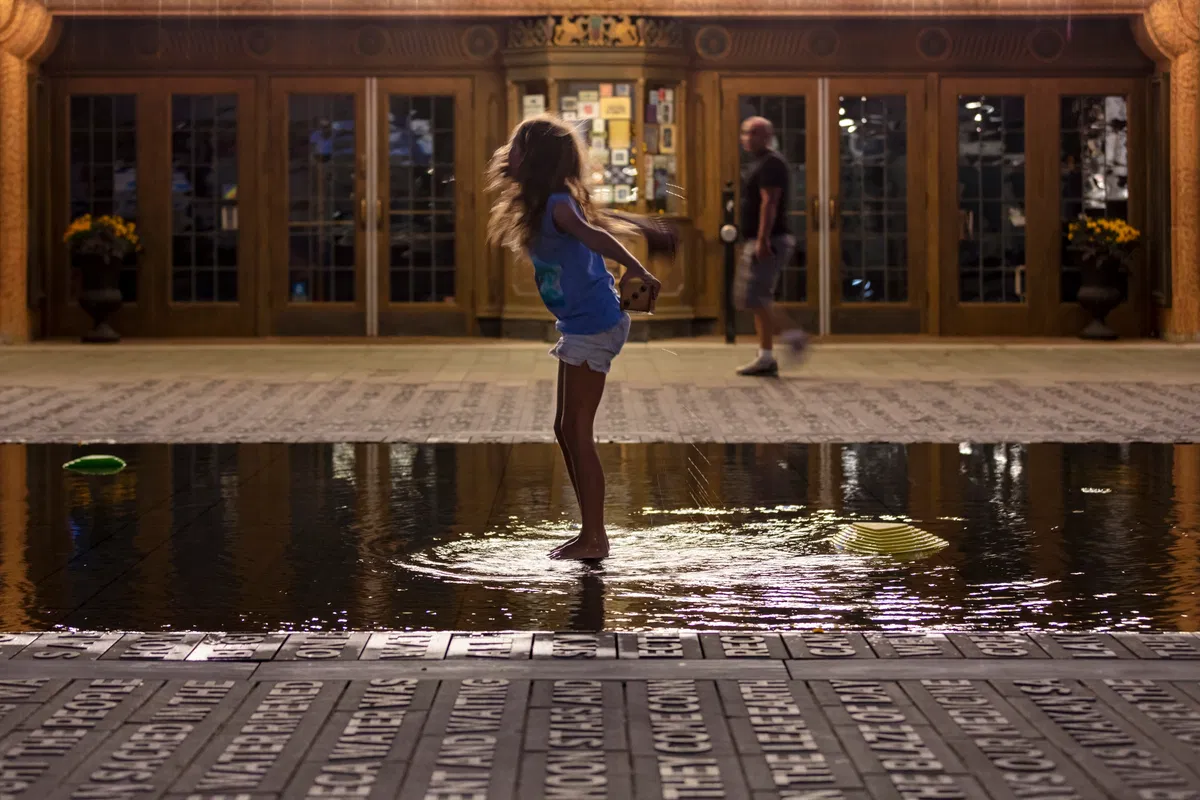
One example is Heart of the City, a project to transform the city center around the Mayo Clinic. We talked with residents, local artists, representatives of Indigenous peoples, businesses, and city institutions to understand what people value in the center and how they want to see it.
Cultural Master Planning as a Tool for Territorial DevelopmentCultural master planning is becoming part of the toolkit for urban development and real estate, linking the identity of a place, spatial solutions, cultural programming, community participation and the economic model at the stage when a project concept is being shaped.mag.humodoc.com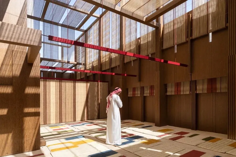
Art became part of the work from the very beginning: artists participated in the design, and their works were integrated into the urban environment.
The solution was also influenced by the climate, with sharp temperature swings between summer and winter. The landscape, materials, infrastructure, and program of use had to ensure comfort in heat, severe frost, and the transitional seasons. Spaces are provided here for everyday life, performances, markets, and city events.
By what signs do you assess the success of such a project in the long term?
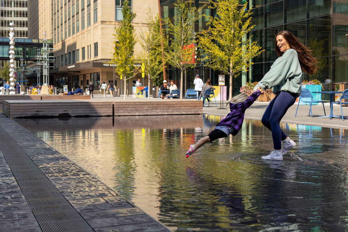
For me, the main sign of success is when people begin to consider a place their own.
Attendance, environmental indicators, economic effect, and community participation are, of course, important. But the environment must become part of everyday life.
A good urban project suits different people and scenarios. A large event can take place here, but on an ordinary day a person should be able to simply come, sit, or meet with friends. The environment should change throughout the day and season and leave people free to use it in different ways.
It is also important to look at the longer perspective: what happens five, ten, or twenty years after opening, how the landscape develops, whether patterns of use change, whether the territory can adapt, and whether it can be maintained in good condition.
This is what shows whether a place has become part of the city's life and whether it retains its value over time.
When Art Becomes Part of the City: ARCHICA 2026 and a New Approach to Urban SpaceOn 5 and 6 October, Astana will host ARCHICA 2026, a professional platform bringing together architects, developers, artists and experts to discuss how culture and art can shape cities. This year, two of the forum’s sessions have been prepared in partnership with international consultancy Barker Langham.mag.humodoc.com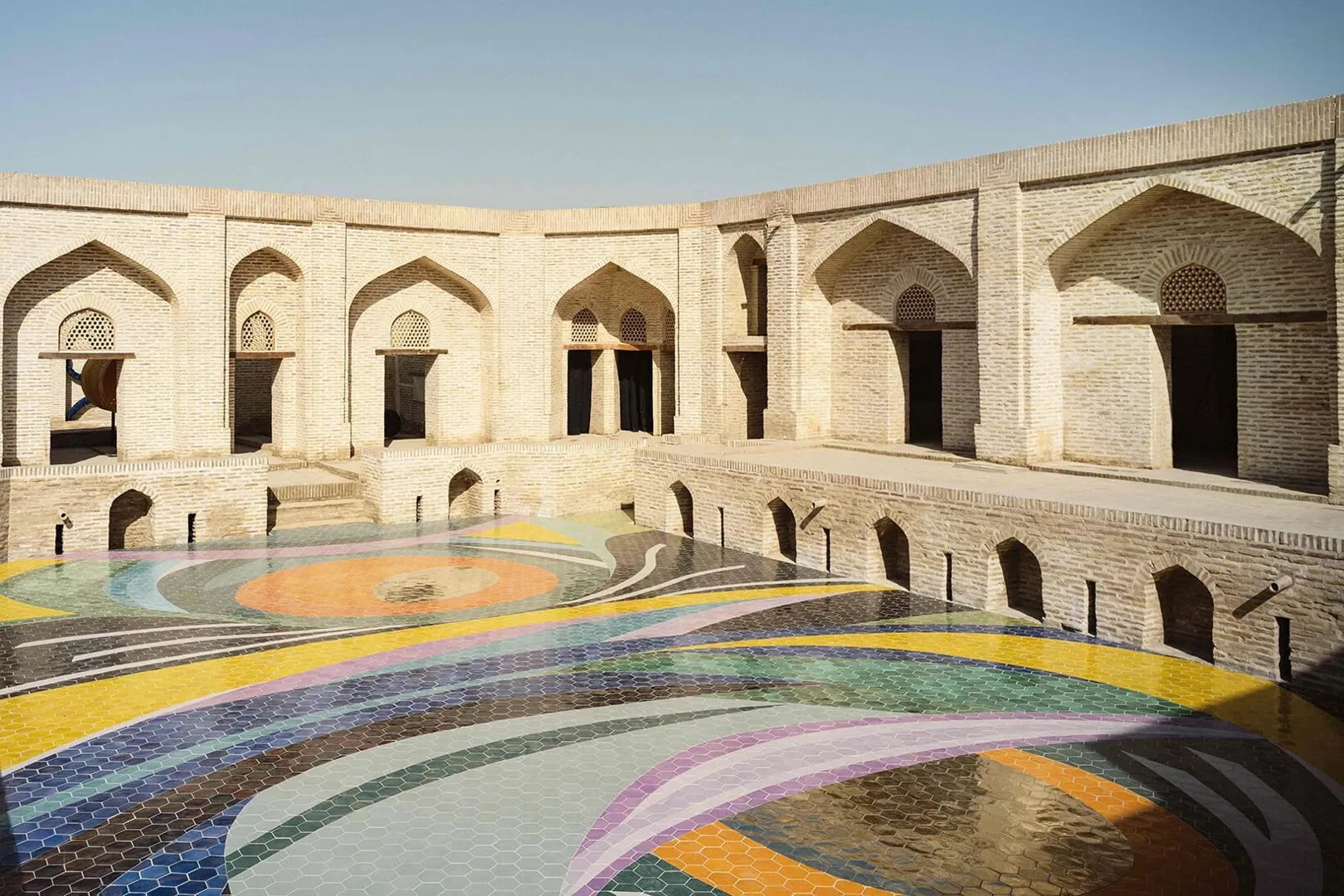
How does landscape architecture shape connections between buildings, streets, and districts?
Architecture creates individual points of attraction and forms boundaries. Landscape and the urban environment connect buildings, streets, infrastructure, districts, and natural systems. These connections determine how people move between different parts of the city and how they perceive it.
At the urban level, landscape architecture, urban planning, and infrastructure must work together. We design connections between buildings and streets, public and private areas, movement routes, and meeting places. Thanks to this, individual projects begin to work not in isolation, but as parts of a single city.
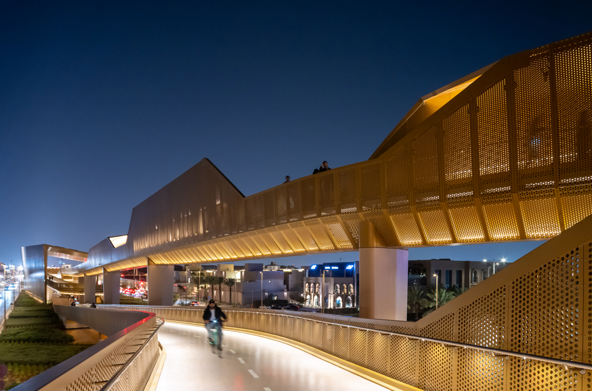
In the Sports Boulevard project in Riyadh, you rethought the structure of an urban corridor oriented primarily toward cars. Which solutions became key?
As part of the project, we rethought the structure of the streets along the entire length of the corridor. The number of car lanes was significantly reduced, cross streets and new connections, wide sidewalks, bicycle routes, and recreation areas were added.
Raised intersections and other measures improved safety and created more balanced conditions for pedestrians, cyclists, and drivers.
The project connects districts, improves access to adjacent development, and creates places where people can walk, meet, shop, and spend time.
We are also seeing significant private investment, both in the development plots provided for by Sports Boulevard and in real estate along its edges. The transformation of the urban environment creates new points of attraction and increases the potential of the surrounding territory.
The City as an Interface: Why a Comfortable City Doesn’t Make People ThinkWe tend to judge urban space by its landmark projects: a beautiful park or a new public square. But before you can enjoy that beautiful park, you first have to get there and then make your way home safely. If the journey itself is inconvenient, even the most spectacular park cannot make the urban environment truly comfortable.mag.humodoc.com
How can the financial value of a cultural project for a city and a developer be assessed, especially if the budget is limited?
Value consists not only of direct revenues, but also of broader effects for the territory. We assess the economic activity, investment, and development that a project can support.
Direct indicators include attendance, length of stay, repeat visits, visitor spending, operating income, and pedestrian flow.
At the district or city level, one can take into account commercial occupancy, property values, development activity, tourism, and investment in neighboring plots. For a developer, demand for space, the pace of leasing and occupancy, and the value the project creates for nearby residential, commercial, and hotel real estate are important.
To assess changes, it is necessary to record baseline indicators and track them over time.
There are also effects that are difficult to express with a single financial indicator. A cultural initiative can shape a district's identity, support local business, attract visitors, and increase the appeal of neighboring development.
With a limited budget, it is important to identify the main goals and direct funds where they will have the greatest effect: connections between territories, an events program, or a cultural anchor.
During the renewal of Peavey Plaza in Minneapolis, it was necessary to preserve the historical character of the square while also improving its accessibility. How did you determine what to preserve and what to change?
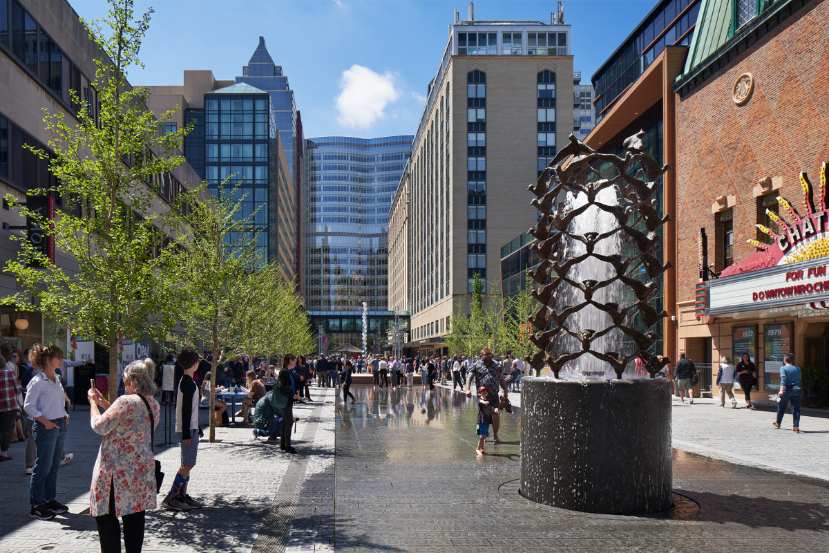
Historical landscapes, buildings and squares hold the memory and identity of a place. First we identified the characteristic features of the original Peavey Plaza design, and then considered which modern solutions could improve accessibility, infrastructure and use of the territory.
As a result, the historical landscape was preserved and complemented with a new layer. The modern solutions are distinguishable but do not compete with the original concept. The character of the square has been preserved, and the square itself has become more accessible and suits a wider range of people and use scenarios.
Heritage is not only buildings and landscapes. It is also spatial connections, materials, craft practices and collective memory. It is important to understand what defines the character of a place, to preserve these qualities and at the same time give the territory room to develop.
In Central Asia, nomadic and sedentary traditions, historical trade connections, the Soviet experience and modern national identities coexist. How can these cultural layers be taken into account in the modern urban environment?
We try to understand the history and culture of a place in all their complexity. For Central Asia this is especially important: the region has been shaped by nomadic and sedentary traditions, trade routes, various religious and cultural connections, the Soviet period and modern national identities. It is important for us to understand which of these layers continue to influence people's lives.
We study how people gather and move, how public and private territories are organized, how landscape and water are perceived, and which materials and craft practices are used.
Ornament and pattern can carry cultural meaning and demonstrate mastery of working with material. We can reinterpret a traditional code or incorporate an existing practice into a project if we understand its meaning and connection to the place.
For craft to become part of the everyday urban environment, artists and craftspeople need to be involved already at the design stage. Their knowledge and skills can be embodied in paving, walls, screens, furniture, lighting, ceramics and water elements.
Craftspeople working together with designers and production teams makes it possible to create modern elements while preserving a connection to local culture.
Master Plan: How to Design a City Before It Is BuiltOver time, humanity moved from an absence of planning altogether, with cities sprawling unchecked, to increasingly rigid regulation. Somewhere along the way, it became clear that a liveable city tends to exist between these two extremes. A master plan is, at its heart, an attempt to find that middle ground: a document that does not prescribe every detail down to the last brick, but does not leave development entirely to its own devices either.mag.humodoc.com
How can large landscape projects take water scarcity into account and at the same time create a comfortable urban environment?
When water is scarce, it is important to choose precisely where and how to use it. Territories can remain green, shaded and comfortable if resources are distributed wisely.
In arid regions we have applied solutions that reduce dependence on drinking water: collection and reuse of grey water, use of treated wastewater, rainwater harvesting, modern irrigation systems, soils that retain moisture better, and local plants adapted to the climate.
We concentrate planting and shading where they have the greatest impact on comfort and public life. Other areas can reflect the character and ecology of a more arid landscape.
Water itself can also be an important element of the urban environment. Movement, sound, reflection and the cooling effect change the perception of space, and they do not always require large amounts of water.
In Central Asia, landscape solutions must take into account the climate, ecology, hydrology and history of life in the region alongside water. Models developed for a wetter climate are not always suitable. Local conditions can and should determine the character of the urban environment.
Read also
Architecture & Urban EnvironmentCultural Master Planning as a Tool for Territorial Development
Anna Oris
 Architecture & Urban Environment
The City That Already Exists
Daria Tolovenkova
Architecture & Urban EnvironmentWhen Art Becomes Part of the City: ARCHICA 2026 and a New Approach to Urban Space
Anna Oris
Newsletter
A letter from the HD editors
Once a week, we send the best stories, events, and cultural discoveries from Central Asia.